|
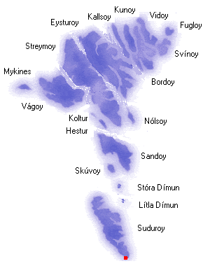
Sumba is the southernmost of the villages on Suðuroy.
The village lies on the west coast as the only one except from Fámjin.
Sumba is said to be one of the oldest villages in the Faroe Islands. Excavations have shown traces from people from the 7th century.
The church in Sumba is from 1887.
Sumba lies behind high mountains and it used to be difficult to reach in wintertime when the storms raged.
In 1997 a tunnel was blown through the mountains from Lopra to Sumba. This makes life easier for people
in Sumba who work in Vágur.
If you visit Sumba when the weather is nice you should take the road over the mountains. On the mountain
in a height of 400 meters there is a high radio-mast. From there it is possible to walk the 50 meters to the
west coast.
From top of the bird-cliffs there is a magnificent view over the sea and rocks deep below. The cape of Beinisvord rises vertically 470 meters from the sea. It is possible to climb Beinisvord from the backside even if it is pretty steep. In 1975 part of the top fell into the sea.
South of Sumba on the south-tip of the island is a place called Akraberg. In present time there is just a lighthouse in Akraberg but a Frisian colony was there from year 1040 until The Black Death killed all of them in 1350. The Frisians were heathen a long time after the rest of the Faroe Islands were christianised.
It is said that they partly lived by piracy and they are mentioned in several Faeroese legends.
Five kilometres south of Akraberg is the southernmost point of The Faroe Islands, a rock called ‘Munkurin’. The sound between Suðuroy and Munkurin is notorious for its strong current. |
|